Plat Maps
Hendren Township, Clark County, Wisconsin
Twp. 26 North, Range 3 West
Clark County Land Records
Clark County Maps
County Townships Map
Surveying Clark County (1842-1856)
First Owners Plat Maps
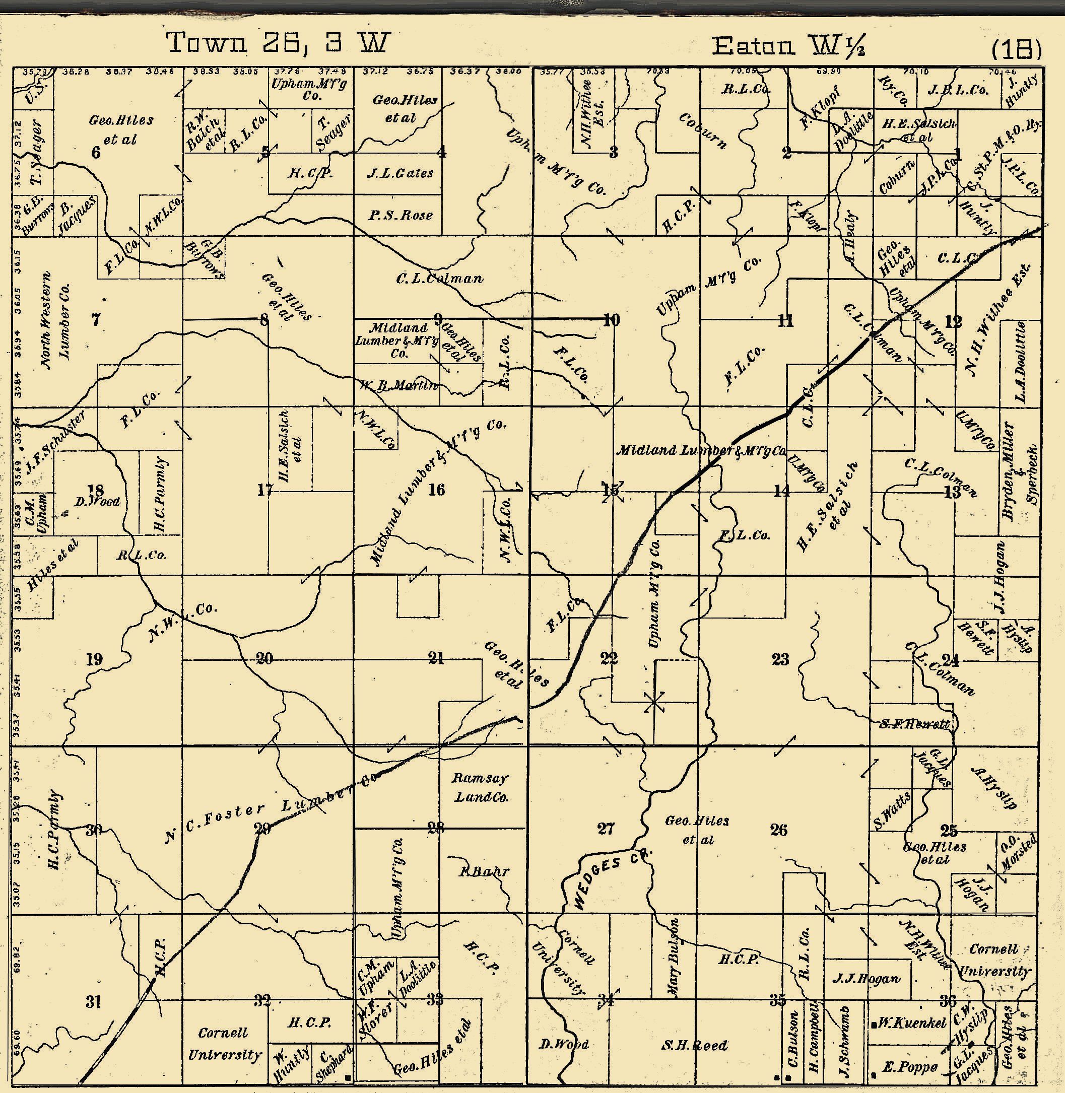
In 1893 Hendren Township was the
west half of Eaton Township.
Hendren Plat Map Project
Because there is so little genealogical
data available for sparsely populated townships, we would like to provide the information
offered by plat maps. Our first two sets were contributed by Alice Braun. We need
volunteers to transcribe each map so the surnames can be indexed on our search engines.
If you can help by typing this information for us or have maps to contribute to
the project, please contact George Plautz
concerning the township and year you would like to transcribe. Because of copyright
laws, we will not be able to display the actual maps which were produced after 1926
unless you are able to obtain permission for us to do so.
The format for gleaning the information
is simply to put the Township at the top and then record the source for the information
along with the year of publication. This should then be followed by a breakdown
of the sections within the township. Record year being transcribed and the names
of the property owners under each section. Here is an example for the Beaver Township
Plat Maps of 1893, 1930, 1997 & 2000 for sections 1, 2 & 3.
TOWNSHIP: Hendren
(formed in 1911 from the west half of Eaton)
Clark
County, WI Internet Library Map Collection
County Map
(shows all the townships)
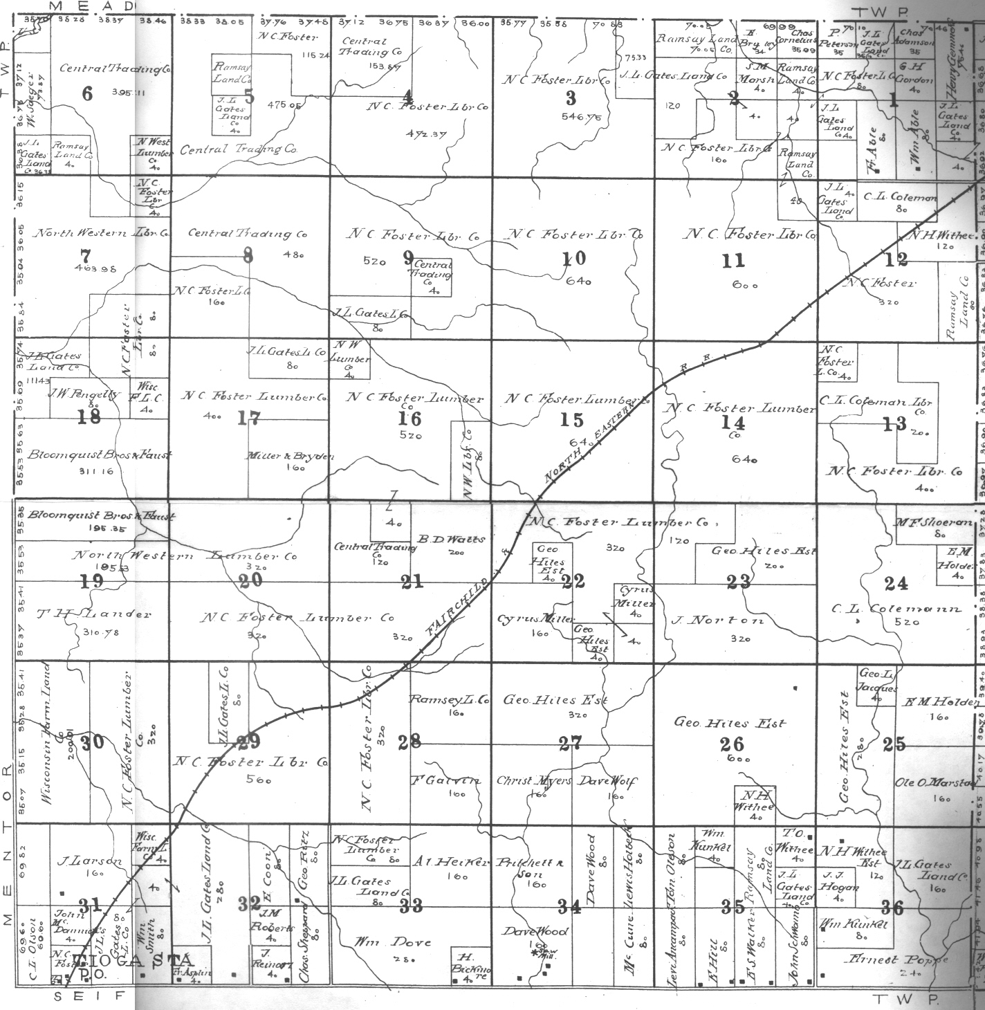
First
Owners Plat Map--Hendren Township
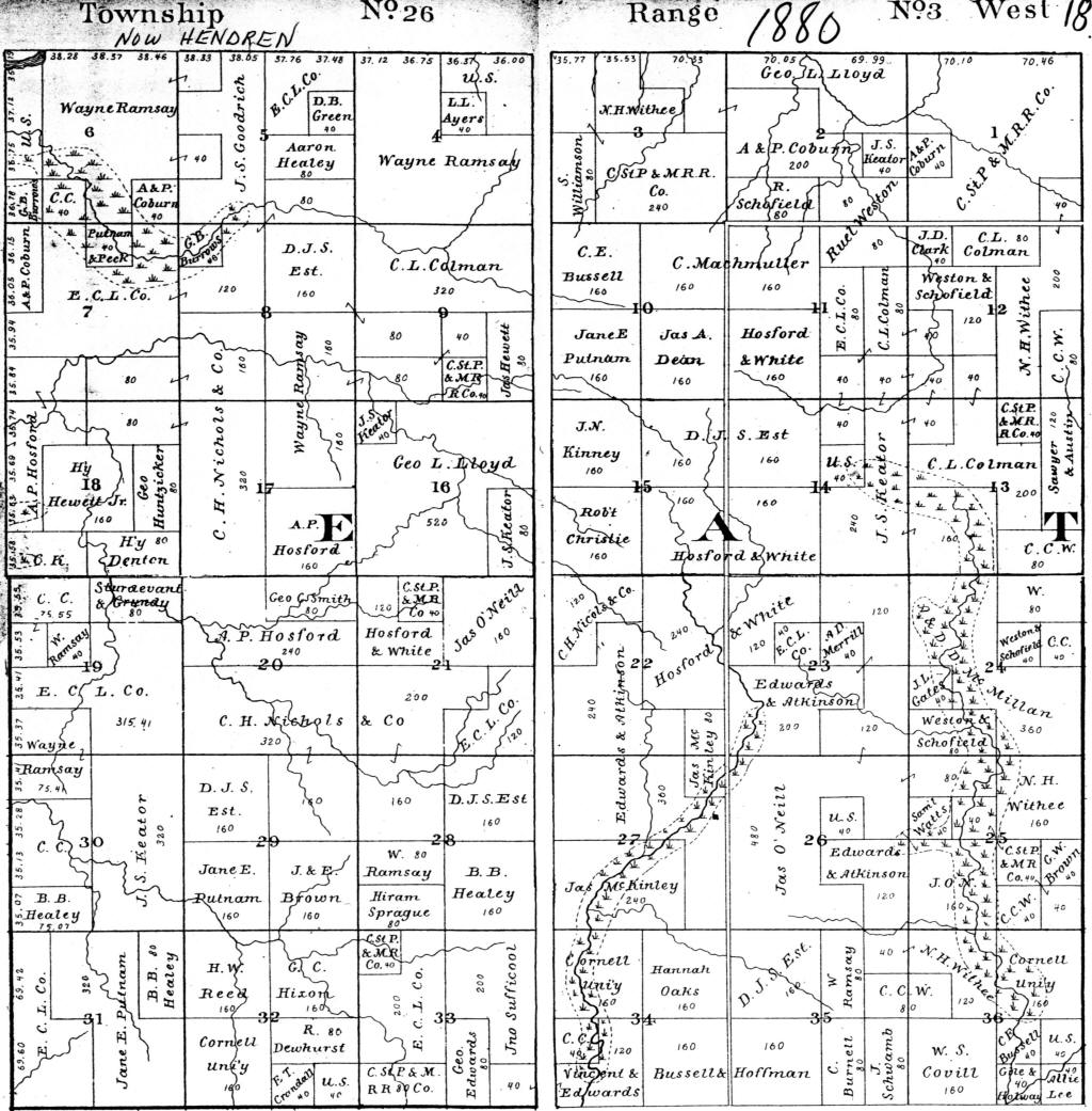
1880 Plat Map--In
1880 Hendren was the west half of Eaton Twp.
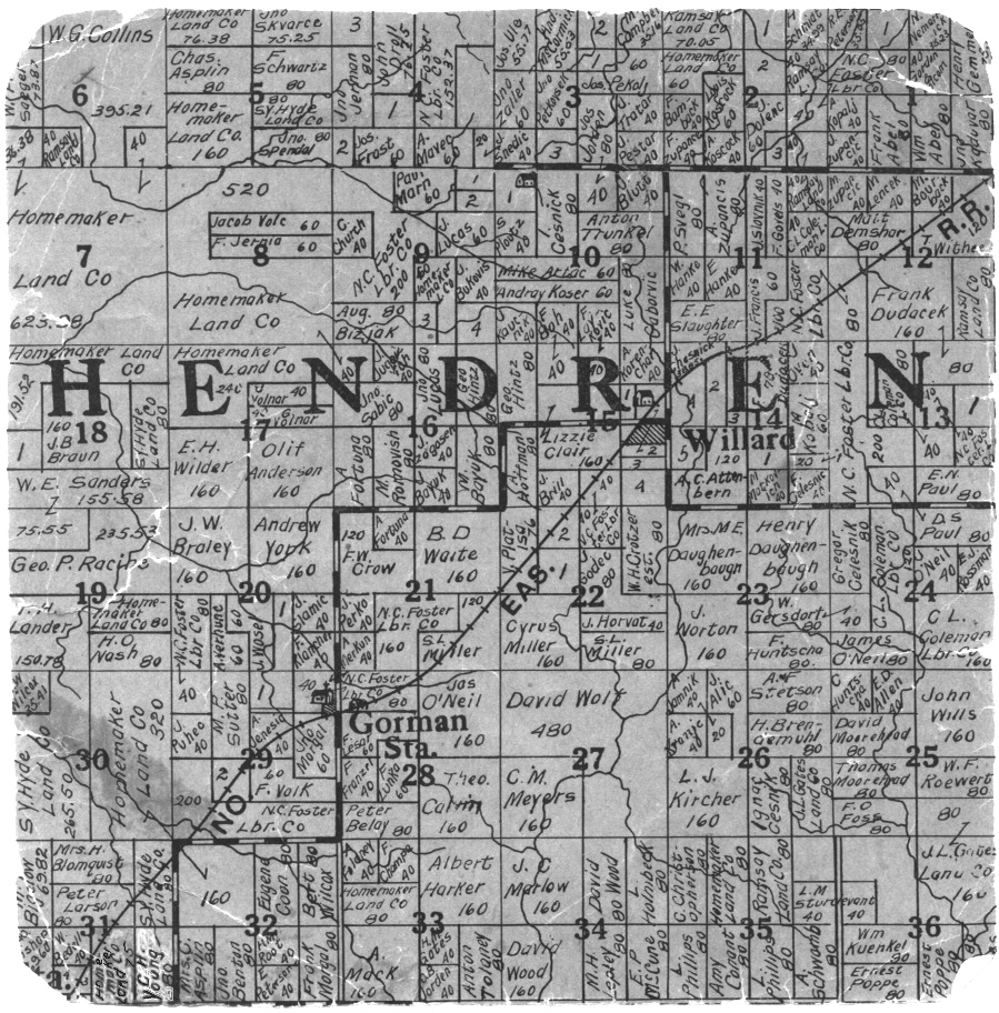
1893 Transcription of Property Owners;
1893 Map -- C. S. Stockwell;
Neillsville, WI (Contributed by Alice Braun);
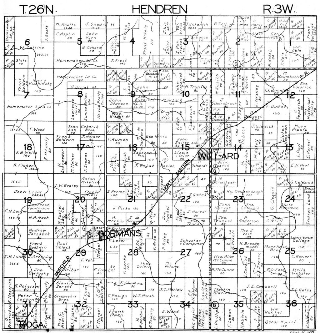
1906 Transcription of Property Owners;
1906 Map--G. A. Ogle & Co., Chicago, IL (Contributed
by Stan Schwarze) *This Map takes a long time to load, but we left it large
for clarity.
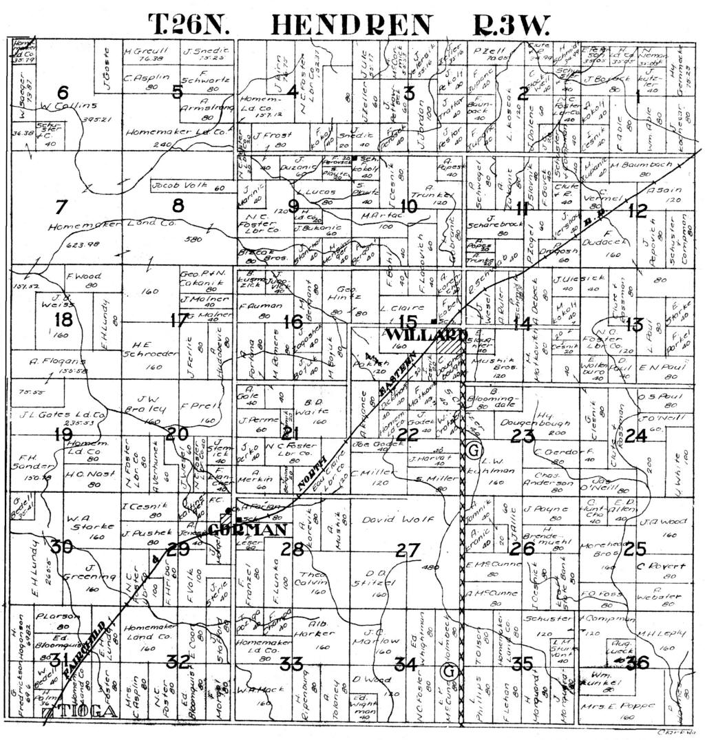
1915 Transcription
of Property Owners; 1915 Map &
Unlisted Property Owners, contributed by
the Thorp Area Historical
Society.
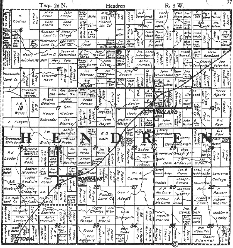
1920 Map--unknown
origin
192? Map--unknown
origin
1926 Map--By Standard
Map Co., Chicago, IL (Contributed by
Paulette Strey).
1930 Map -- Standard Map Co., Chicago, IL (Contributed
by Alice Braun)
1938 Map--Standard Map Co., Chicago, IL (Contributed
by Owen Haigh)
1997 Map-- Cloud Cartographics, Inc., St. Cloud,
MN 56301 (contributed by Owen Haigh)
2000 Map-- Farm & Home Publishers, Ltd., (Contributed
by Eileen Krapf)
Hwy 69 North
P.O. Box 305
Belmond, IA 50421-0305
Ph: (641) 444-3508
Fax: (641) 444-5150
E-mail:
info@farmandhomepublishers.com
|